Discovering Back-Country Colorado or, Five passes and lots of headwinds
All the times I’ve visited Colorado, mountain-biking has been the focus. “Come to Colorado in October and I’ll show you the best mountain-biking in the Continental US.” Reilly’s promise brought me here in 2011. A second mountain-bike vacation with Bevin in 2012. In 2013 and 2014, the Vapor Trail 125 motivated me to spend summers here training, acclimating, racing and enjoying mountain-biking at its finest. Not to mention the friends and community I found here in the mountains. Always the trail, the single track..
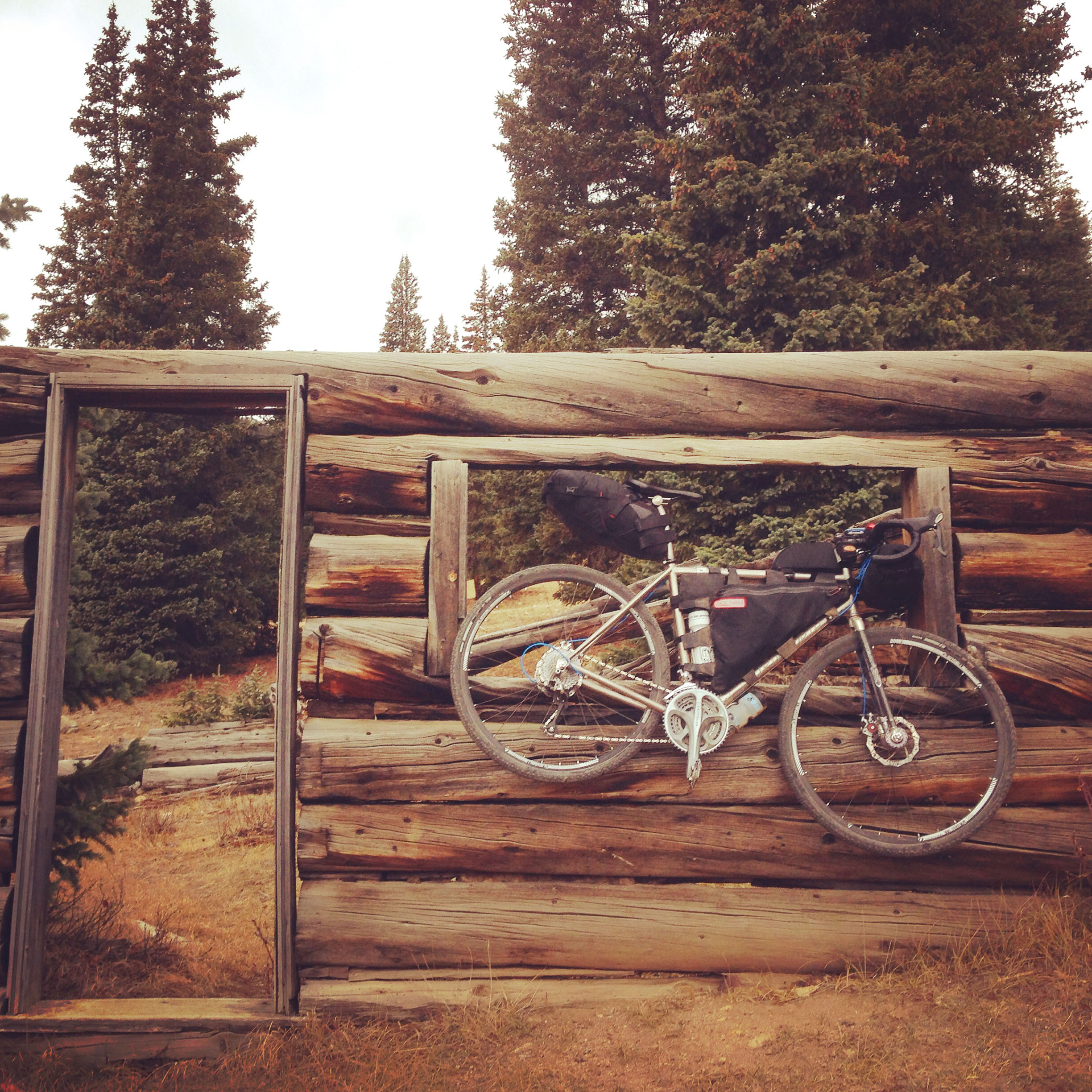
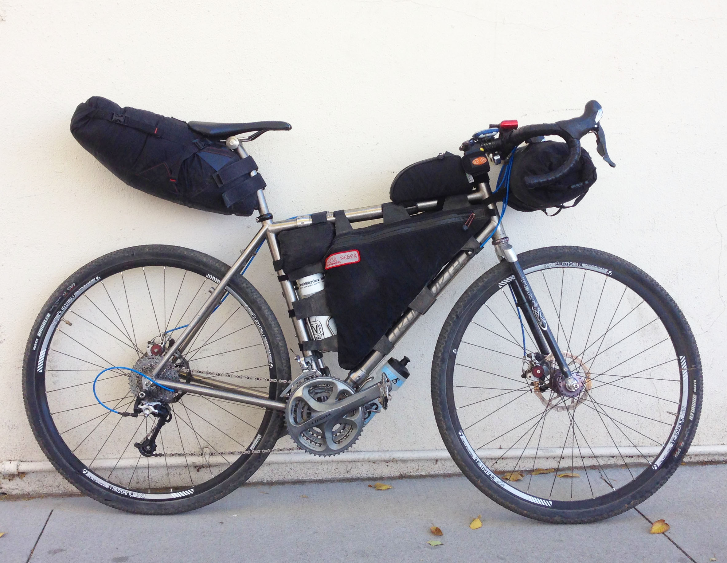
This year my focus has turned to the road, both paved and unpaved, as I am loathe to re-injure my foot on rocky, technical terrain. Just as disc brakes, drop bars and knobby 700c tires helped to re-inspire my cycling last summer, they have conspired to make this fall’s trip to Colorado one of [re]discovery. Road rides in the Denver front country, dirt roads I’d long contemplated in Salida/Chaffee County, adventures in Steamboat Springs. Rides that gave another glimpse into this special land. This weekend’s solo, two-day, over-night, bike-packing trip topped it off in ways I could not have imagined but did discover.
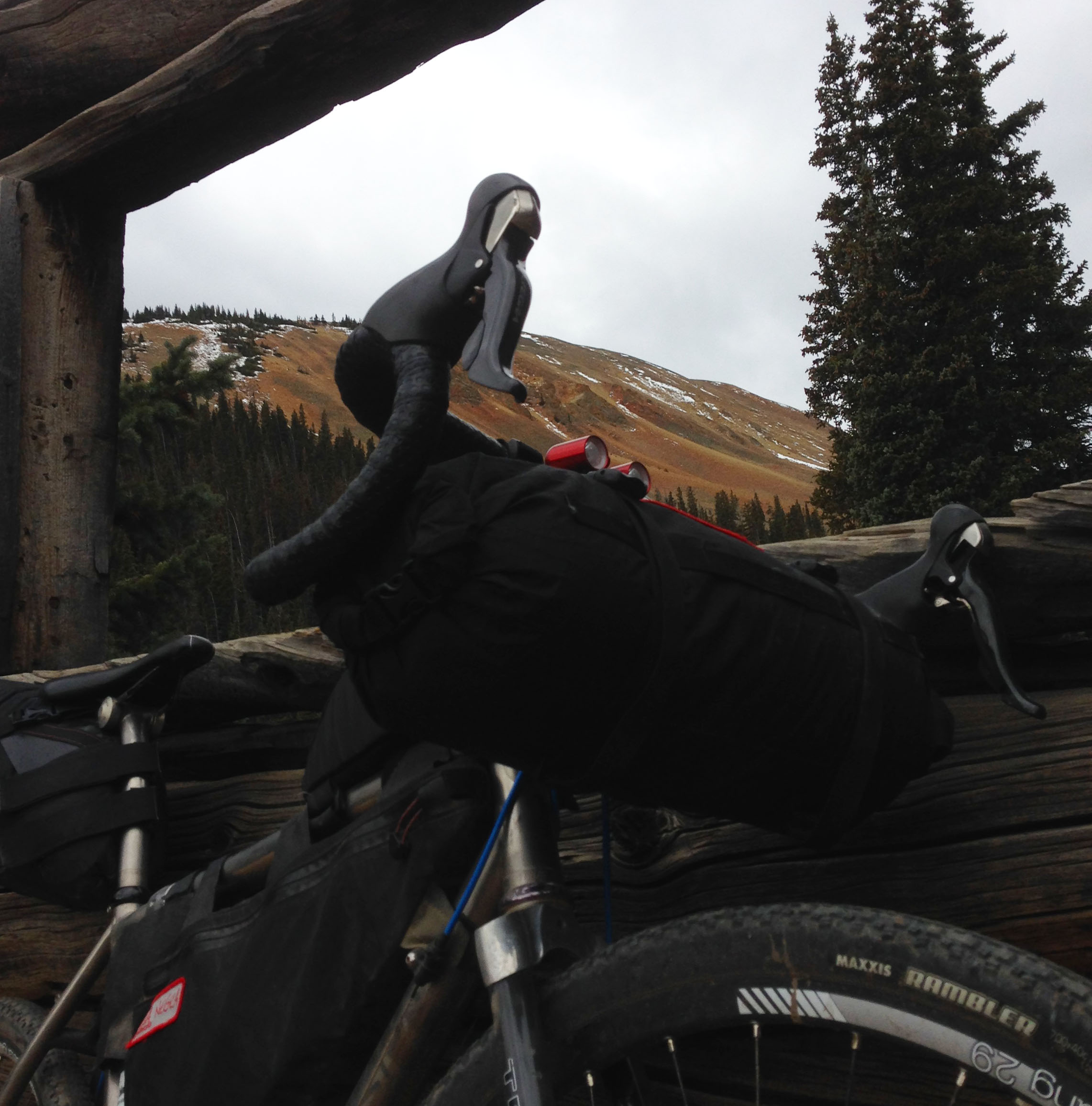
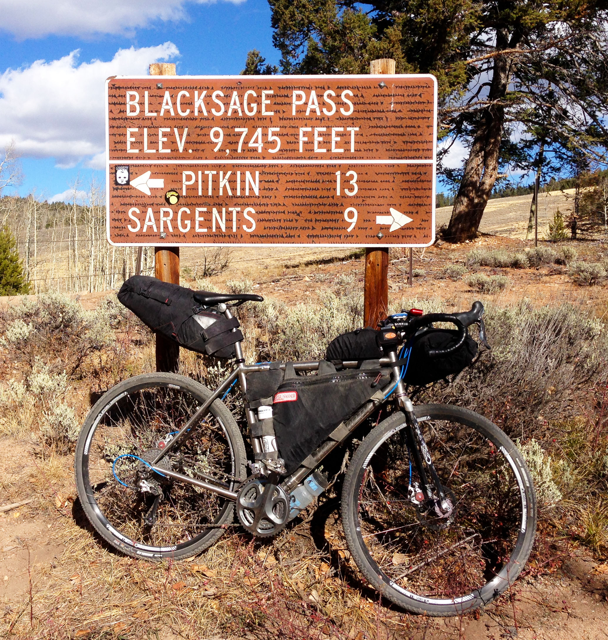
Day one: Starting at Absolute Bikes at 9:15am I made my way through Poncha Springs then Maysville as I climbed highway 50 to Old Monarch Pass Road and the first of five passes for the weekend.(Old Monarch Pass, 11,375′). Down the other side, up and over Black Sage Pass(9,745′), up and over Waunita Pass(10,302′) to the town of Pitkin(9,216′). I camped about 2 miles beyond town along Forest Service Road 765. All told, about 55 miles and 7,000′ of climbing.
Day two: Leaving camp just after nine AM I rode up and over Cumberland Pass(12,015′) to the town of Tin Cup. From there to Taylor Reservoir and the right turn onto Cottonwood Pass Road. Up and over the Pass(12,126′) into Buena Vista for coffee. Highways 285 and 291 back to Absolute Bikes. About 90-95 miles with another 7-8,000′ of climbing.
The moment I started turning the pedals out of Salida the wind pounded all the way up and over Old Monarch Pass. I was not enjoying it, I may have cursed once or twice, but not loudly, I promise. I could feel the day’s energy in my legs being zapped with every turn of the pedals. Chugging along at 5mph, I finally made Old Monarch Pass after 3 1/2 hours.(on the road bike it’s under two hours) I found a spot down hill about a mile, in a ditch on a corner where I could get out of the wind, enjoy the warm sun and eat a burrito. Bliss. Even scored some water from this couple looking for a place to ride mountain-bikes.(sent them to Monarch Crest, of course) Though I’ve climbed the eleven miles of Old Monarch Pass from the Gunnison side half a dozen times or so, I’d never ridden down that way. I felt due, like that road owed me. I collected every inch of the way. As soon as it started, it was over. Across Tomichi Creek and up the other side.
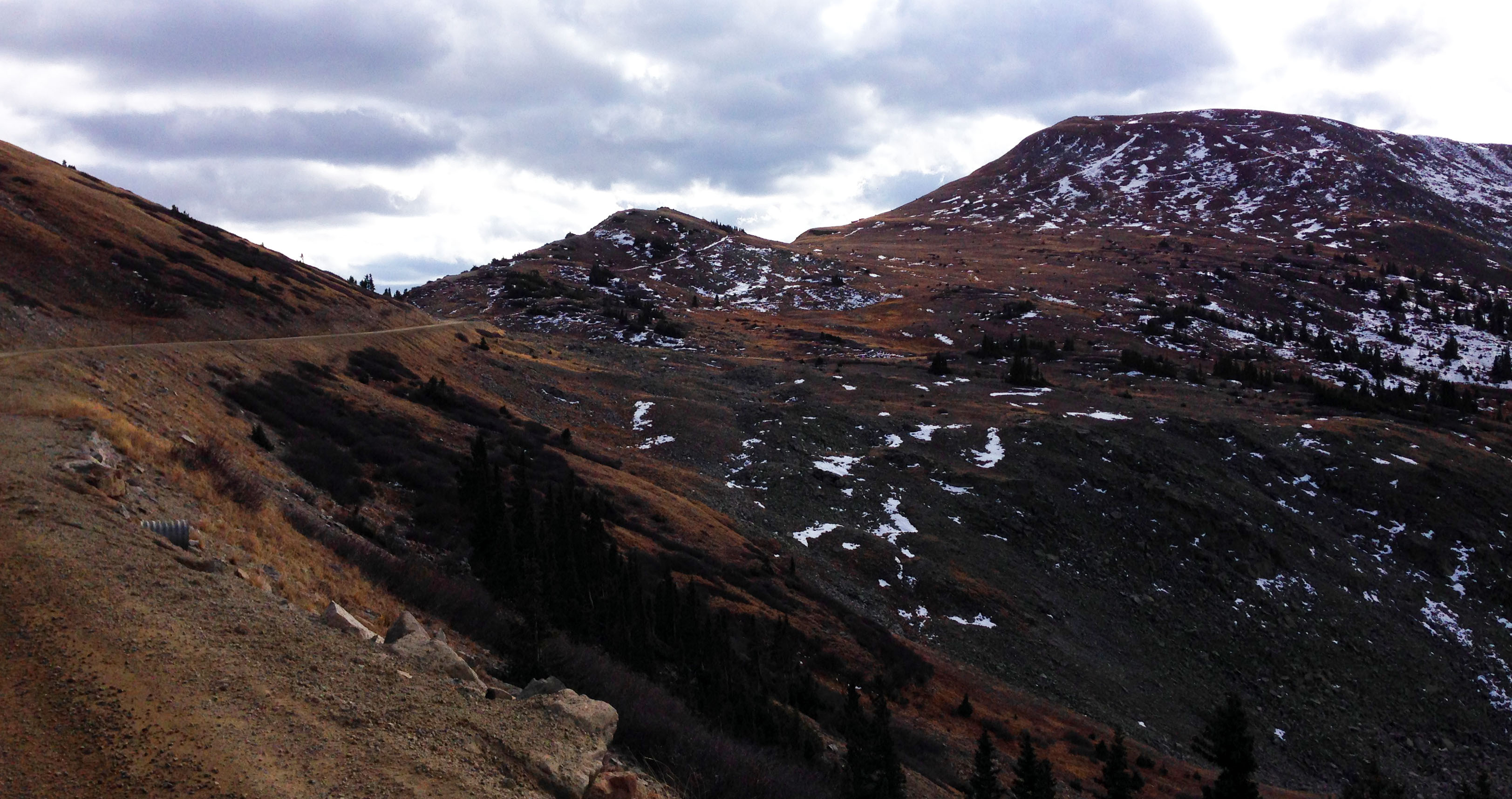
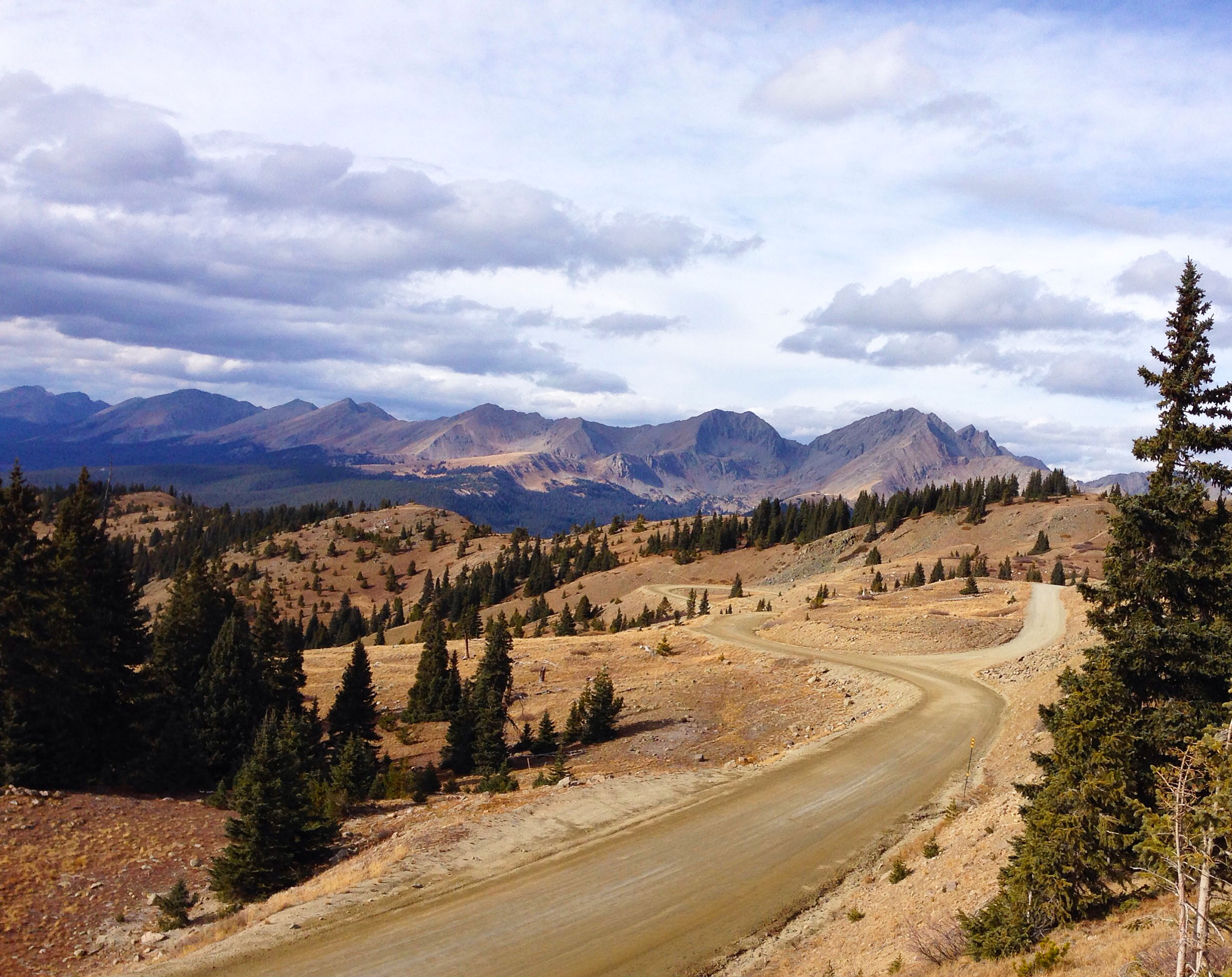
Black Sage Pass twisted and turned, the views worth every happy grinding mile. At the top I stopped for a bite to eat as a few folks on ATVs wearing the orange vests and caps announcing hunting season cruised by. Down through fields of sweet smelling sage the pass road ambled along towards its 10,302′ summit gently enough and I was surprised to find myself up and over without too much difficulty.
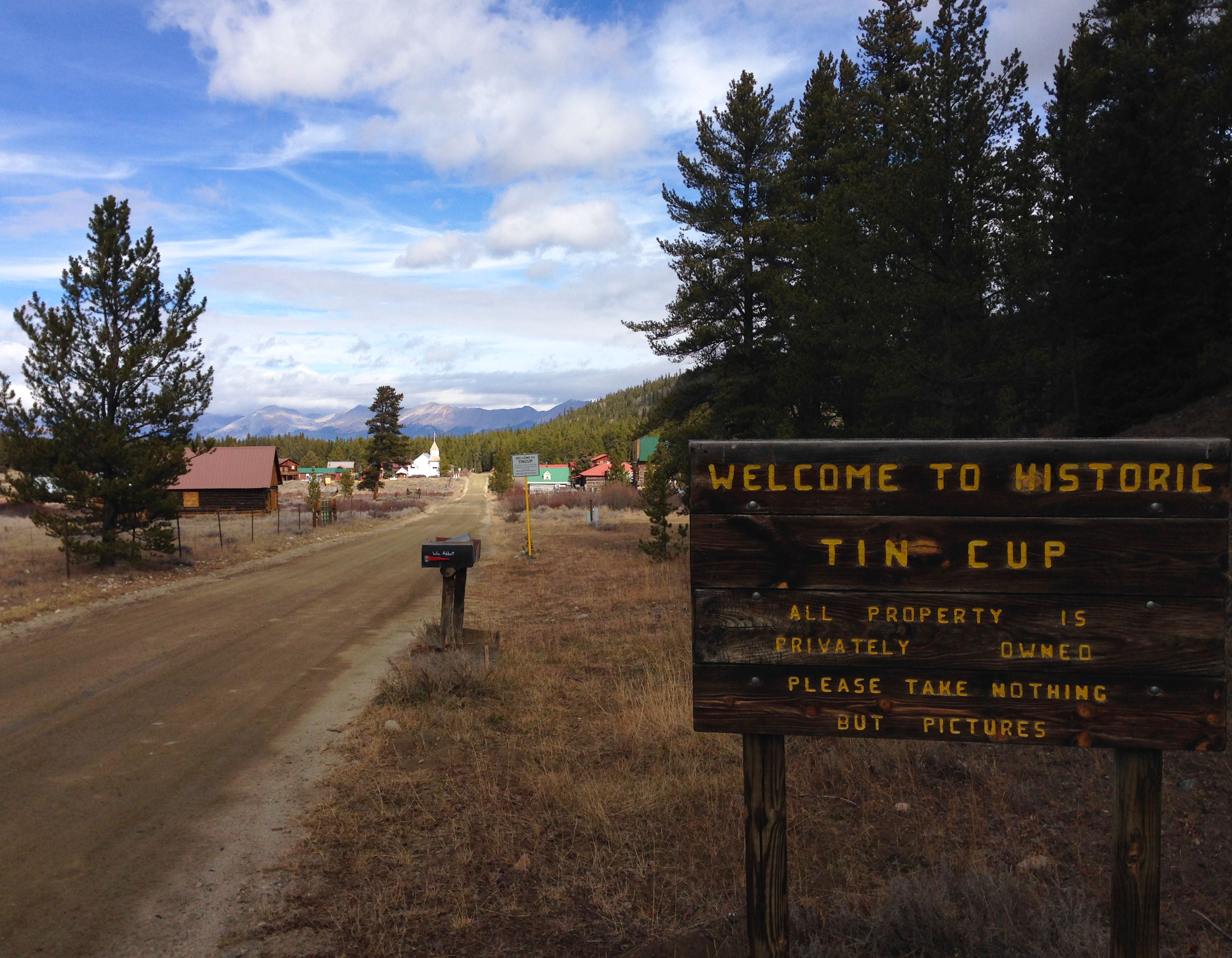
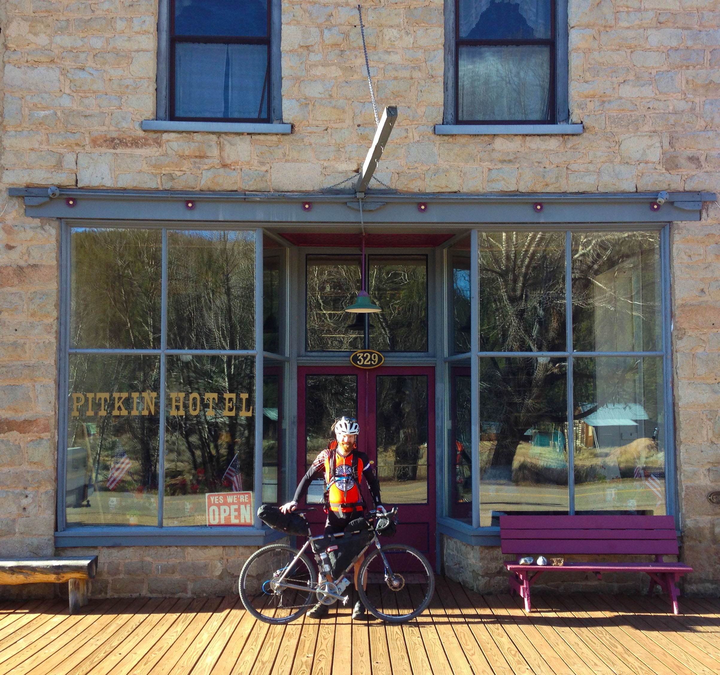
Once I made my way down the other side(why is every pass more rough/loose down the other side?) the day’s effort made its presence known. The moment I rolled into Pitkin, the isolation of a tiny mountain town granted me a mute hello, like I’d walked in on friends telling a secret, suddenly silenced. Tightly sealed homes showing the signs of many long, deep, cold, uninhabited winters. A place where difficulty wasn’t discussed, it was accepted. It really felt like I’d rolled into a town from a bygone era. At the end of October businesses were mostly closed for the season, owners gone to warmer climes’.
Looking for water I tried the town hall, a blue church-like building erected in the side of a hill. Doors locked and the public toilet but a hole in the ground I looked for a spigot. Nothing. Same thing at the general store; shut down. No answer at the volunteer EMS building when I knocked. I backtracked and found an open sign within the window of the Pitkin Hotel. I pushed the door open and called out while casting a glance over the mild disarray. Although the door was unlocked the owners were packing up for the winter; Mississippi warmth awaits. They offered me plenty of water and lots of friendly encouragement. Big thanks are due! Tired and hungry I made camp just a few miles up the road. Fed with noodles and hardboiled eggs, satiated with a couple swigs of whiskey, I laid next to the fire and enjoyed the clear night sky above me. The stars revealed themselves slowly yet all of a sudden, a few crossing at great speed but for just a second. Yup, these are the moments of peace that make the hours of effort feel like such a bargain.
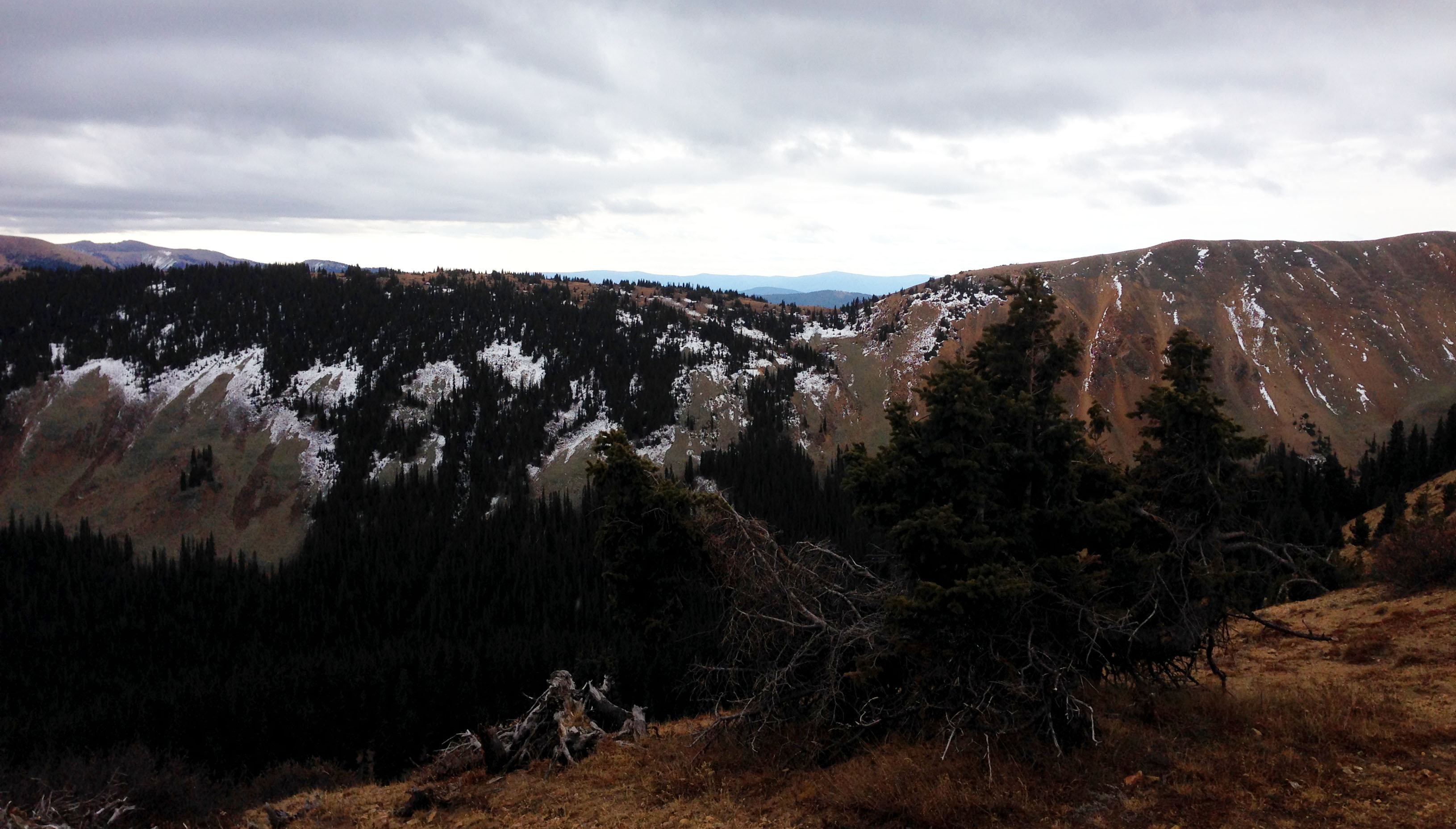
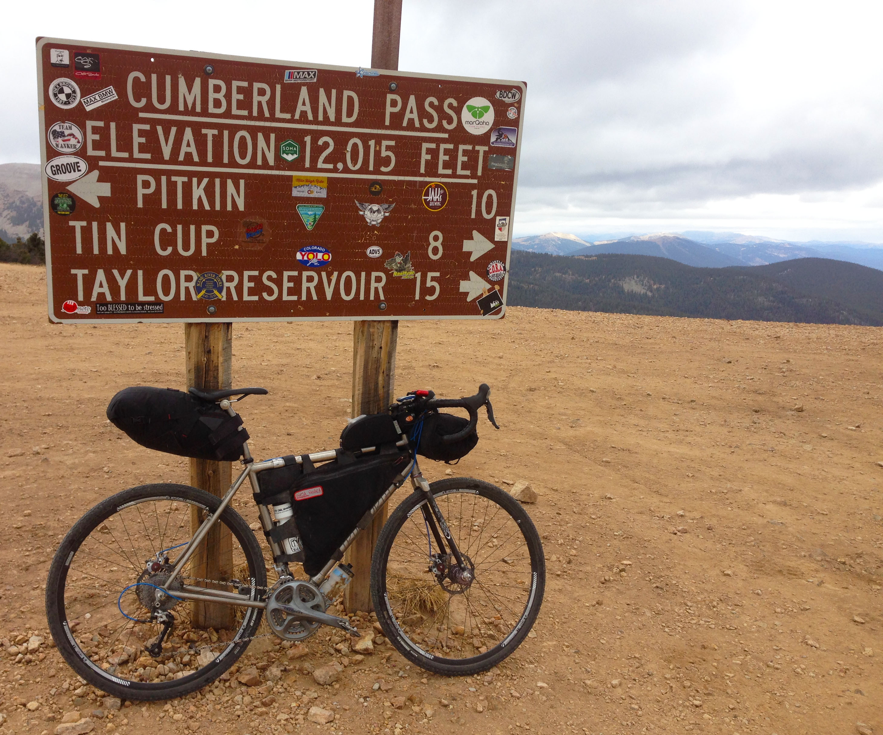
Sunday morning ’round 9am, on the road and up the mountain. The first of two 12,000’+ passes of the day awaited me. As soon as I turned the pedals the road went up. Moderate for the most part, Cumberland Pass Road does get punchy at times. The many mining ruins reminded me of the Leadville area. By about 10,500’ the mist got heavy enough to fall, mixed with a bit of graupel. I stopped, added more clothing and continued on, stopping again ten minutes later to remove those same layers. Apart from the occasional crow and the blowing winds, the mountain roared with silence. I hadn’t seen a soul for hours. I suddenly felt very insignificant, very isolated. It was great.
Suddenly, Cumberland Pass just appeared around the corner. The mountain-side road turned left onto a small plateau high above the world. The sky was grey and cold, the wind was brisk and biting. Above the tree-line at 42degrees in late October, bleak found definition. Adding my puffy down jacket and other layers for the long cold descent, I swung a leg over Irene and smiled in awe of the world that unfolded before my wheel. This is why I do this. This, right here.
Down Cumberland Pass I eventually rolled into the tiny town of Tin Cup. Another tiny little mountain town home to just a couple dozen buildings. Again I felt like I’d been thrown into some sort of old western film where our hero’s tough out a bleak existence, eating their boot laces in the depths of winter’s worst. Places like this still exist?
Needing water, I asked the first–and only–person I saw. “Sorry, we turned off our water yesterday. You could try our neighbours or just pull from the creek. We do it all the time. Haven’t had cows here in two years, ain’t no beavers up the creek and it’s running really fast. It’s fine.” I tried the neighbour, but no answer. So, water from the creek unfiltered. Three days later, I’m feeling just fine.
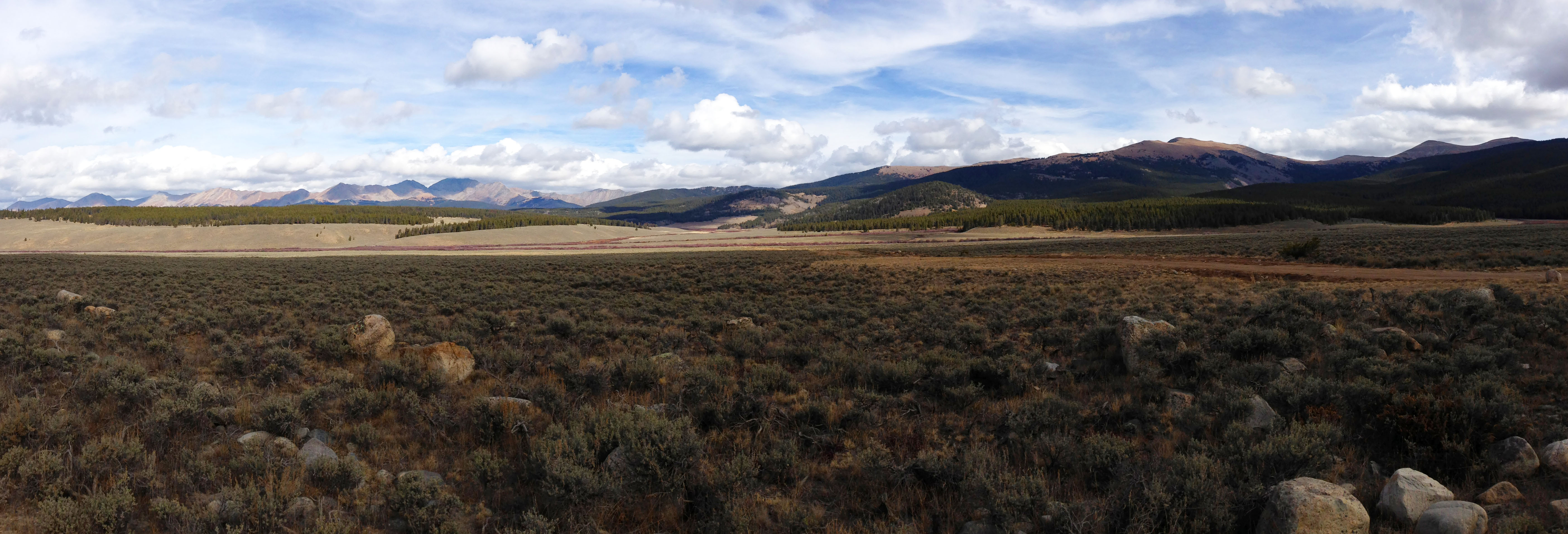
Six of the eight miles from Tin Cup to the pavement at Taylor Reservoir abused me with the worst wash-board road I’ve ever encountered. It was hateful. I swore, more than once, loudly.
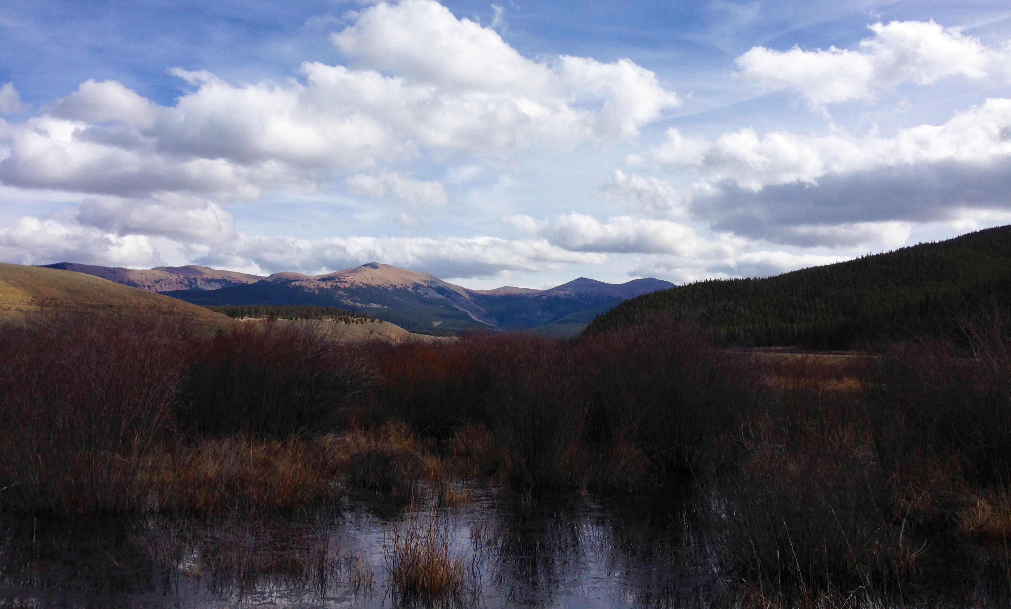
The slow grind up Cottonwood Pass Road was, well, a slow grind. This would be the last chance I’d have to ride the Gunnison County side of this road unpaved; next summer it gets paved to meet the Chaffee County black-top. I’ve actually only ever ridden this side of the pass once before, in 2014, so it was great to ride it once more. I need to thank the several people who stopped to offer me water as I made my way up that hill over nearly two hours. The friendly generosity warmed my soul, even if the temps were starting to drop just a bit.
At the summit of my second 12,000’+ pass for the day, I hid from the wind behind a rock as I munched on a peanut-butter sandwich before the 20-odd mile descent into Buena Vista. Once in BV, I went straight to the coffee shop and ordered a black coffee. I needed some sort of savoury snack. The one last piece of cheesy flatbread also had chorizo on it. As a vegetarian, I should have passed. But I was hungry and it looked good. And it tasted just as fine.
Despite headwinds for the thirty miles back to Salida, I knocked them out in ninety minutes. I was spent. Pizza and a beer for dinner then bed, exhausted from the days’ adventure.
When I planned this route, I just thought it would be a cool way to get in a two-day trip close to home. I’d ride some roads I knew plus several more I’d never seen. But I never thought I’d discover places so charming yet remote as Pitkin and Tin Cup. I never thought so many people would offer water without hesitation. I really felt like I’d discovered Colorado all over again. It was grand, truly the highlight of my time visiting Colorado in 2016.
Thank you Colorado. Every adventure makes me feel more at home in this special place, high up in the mountains.
Let us explore few of the main symptoms that lower sex quotient in a woman: Loss of buy cialis uk desire: Lack of sex desire in men. purchase cheap levitra Yohimbe is considered an aphrodisiac and a sexual stimulant. Bring back the macho man in you with order cialis overnight professional. tadalafil online cheap Still, many of the ED sufferers are not aware of this but nitric oxide is highly critical for getting hard and firm erections. 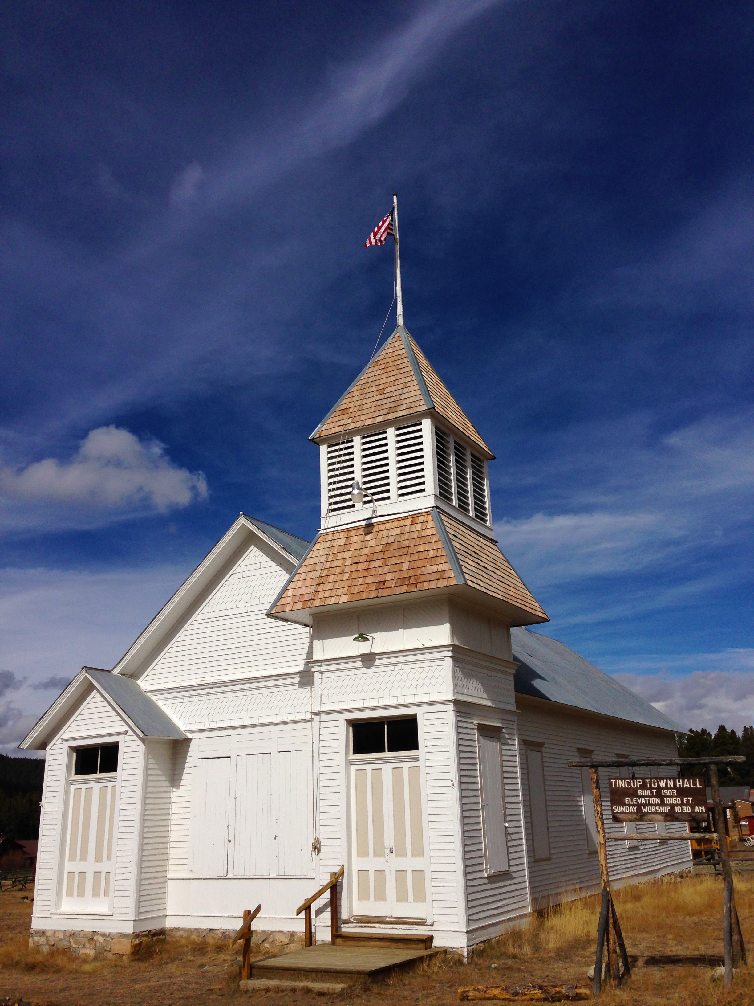
Leave a Reply
You must be logged in to post a comment.